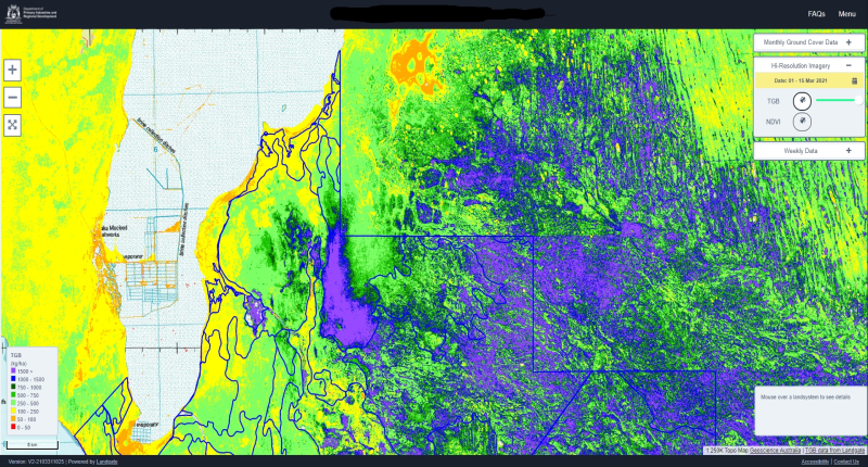
- Pastoral Remote Sensing tool uses satellite technology from NASA
- The government developed tool is free and online for land management uses
- PRS helps pastoralists monitor ground cover conditions and seasonal changes
Western Australia’s Department of Primary Industries and Regional Development recently launched a new piece of technology to assist pastoralists with land management.
The free online tool called “Pastoral Remote Sensing”, and uses technology that is out of this world:
“The free online resource is based on satellite imagery, sourced from NASA and the Copernicus Australasia Regional Data Hub, and provides current and historical estimates of total green biomass, vegetation cover and rainfall for every pastoral lease in WA.”
During 2018 and 2019, seasonal conditions were particularly harsh, prompting the development of the tool. Agriculture and Food Minister Alannah MacTiernan said: “This new resource will be particularly useful in dry seasons, informing crucial stock and land management decisions to best manage the condition of both the animals and the rangelands.”
PRS screenshot of the monthly ground cover graphs

Providing information on ground cover conditions and seasonal trends, the tool assists pastoralists to “guide management decisions and on-ground monitoring and measurement.”
“This means pastoralists can be more agile in managing their operations, while optimising the condition of the rangelands according to seasonal variability.”
Alannah MacTiernan, Agriculture and Food Minister
Alongside the land management tool, a training package will also be “delivered to consultants, industry service providers, grower groups and department officers.”


